The Problem
40% of underground mining fatalities result from ground falls. Yet confirming ground support compliance still relies on visual inspection.
The reality today:
- Handover documents are signed based on visual inspection
- No hard data exists for incident investigation
- When something goes wrong, there's no "before" to compare to "after"
Our Solution
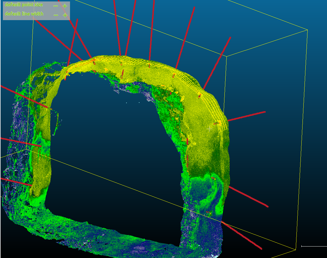
Bolt Mapper uses physics-based detection to automatically identify and document rock bolts from LiDAR scans—creating the hard data that's missing from underground operations.
100% Accurate Documentation
90-95% automatic detection using physics-based algorithms. Human validation brings it to 100%. No guesswork.
Physics-Based, Not Black Box
We use ambient occlusion, geometric analysis, and clustering—not opaque machine learning. You can understand and trust the results.
Mine-Wide Hazard Mapping
Aggregate bolt data across your operation to identify areas with subpar installation patterns before they become problems.
Why Physics-Based Detection?
Machine learning approaches like DeepBolt achieve high accuracy rates (~96%), but they're black boxes. You can't explain why they detected—or missed—a specific bolt.
Our physics-based approach:
- No training data required — Works on new sites immediately
- Interpretable results — You can see exactly why each bolt was detected
- Human validation — Engineers review and correct the 5-10% uncertain cases
- Builds quality data — Human corrections create a validated dataset for future ML enhancement
The result: 100% documented accuracy you can stand behind in audits, investigations, and reviews.
Value Propositions
Regulatory Compliance
Support your Ground Control Management Plan with actual data. Give external reviewers documentation based on scans, not notes.
Contractor Accountability
Replace subjective visual inspection with hard data. Protect both mine operators and contractors with documented evidence of installation quality.
Stability Assessment
Analyze bolt spacing, installation angles, and patterns. Identify areas where ground conditions or installation quality may pose risks.
Convergence Monitoring
Use detected bolts as control features to correct LiDAR drift errors. Measure closure directly from bolt positions over time.
Incident Investigation
When something goes wrong, you have documented before-and-after data. Evidence instead of word of mouth.
Hazard Mapping
Roll up bolt data across your operation. See where installation quality varies and where attention is needed.
Regulatory Context
Canadian mining regulations increasingly require documented ground support management:
- Ontario Regulation 854 — Section 73 requires quality control programs for ground support
- BC HSRC — Ground control management plan requirements
- MSHA — Penalties up to $242,000 for flagrant safety violations
The industry is moving toward documentation. Bolt Mapper provides the data to meet these requirements.
Current Status
Interested in a pilot? We're looking for underground operations to test and refine the system.
Resources
Technical Whitepaper
Deep dive into the physics-based detection methodology, validation results, and technical architecture.
DownloadExecutive Brief
High-level overview of the business case for defensible ground support documentation.
Download